Map Exercise: Europe

Rivers

The Dnieper River begins in the Russian oblast of Smolenskaya and flows west into Belarus, where it turns south and follows near the border until it reaches Ukraine. From here, it flows mainly south through a series of large river-lakes and the city of Kiev, and Dnipropetrovs'k before reaching the Black Sea near Odessa.
The Po river begins in the mountains of northern Italy and flows east, past Milan until it reaches the Adriatic Sea.
The Tagus River begins in the Sistema Ibérico of eastern Spain. From there, it flows west until it reaches the Spanish Portuguese border where it meets the Atlantic Ocean at the city of Lisbon.
The Danube begins in south-western Germany, flows into Austria, through Vienna, then marks the Slovakia / Hungary border before it moves south into Hungary proper. From there it flows straight south, through Budapest and on until it hits the Hungary / Croatia / Serbia border and follows the Serbia / Croatia border for a short while until it moves east and across Serbia, through Belgrade, and continues until it reaches the Romania / Serbia border. It follows the Romanian Serbian border until Serbia turns into Bulgaria and continues east along that border until it is almost to the sea, when it turns north along the coast, through Romania until it reaches the southern tip of Moldova where it makes another sharp turn and flows east along the Romanian Ukrainian border into the Black Sea.
The River Torne begins in northern Sweden near the Swedish Norwegian border at Lake Torn (Tornetrask). From here it flows southeast until it meets the Finnish Swedish border and follows that south until it reaches the Gulf of Bothnia and the Baltic Sea.
The Elbe River begins in the Sudeten Mountains of the Czech Republic near the border of Poland. From there it flows west and then north into Germany and from there north and the west. through Hamburg and into the North Sea.

Mountains

The Pyrenees mountain range lies along the border between Spain and France. They also mark the narrow point between the Iberian Peninsula and the rest of Europe.
The Grampian Mountains mark the beginning of the Scottish Highlands and run east and west from Aberdeen on the east to the Atlantic coast on the west.
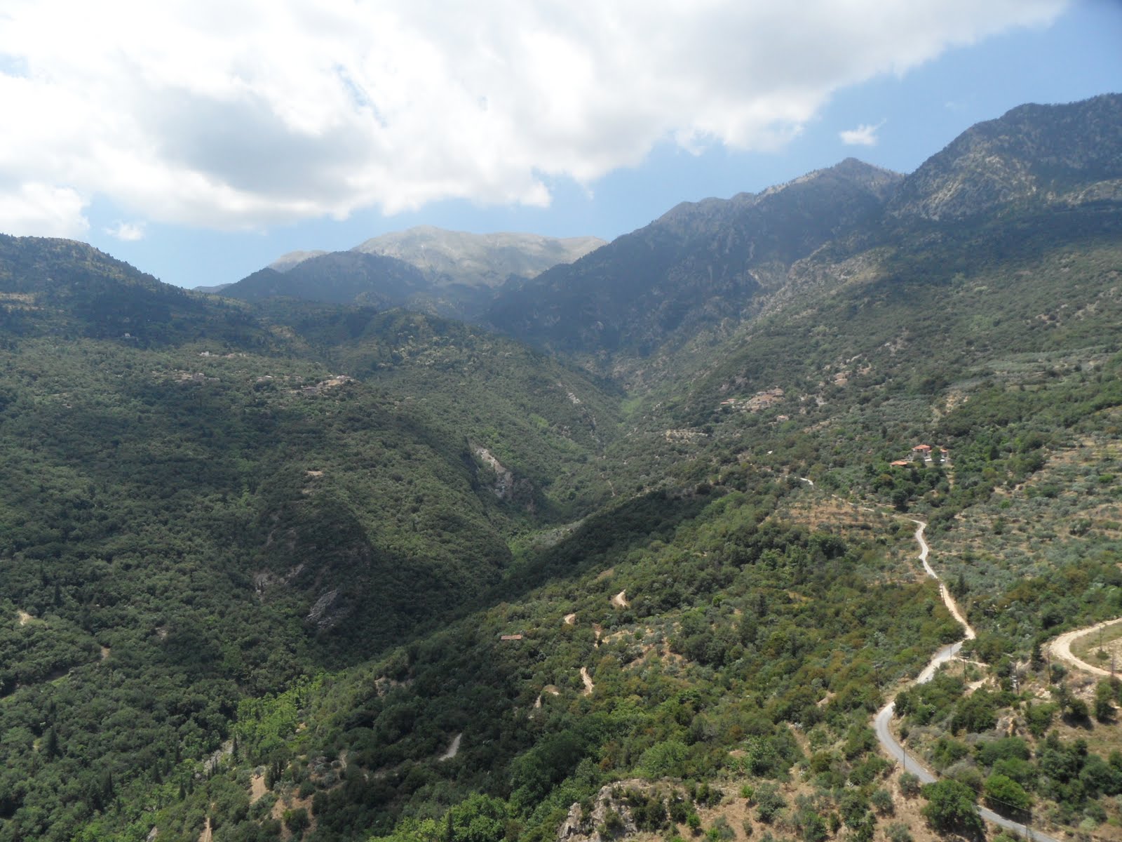
The Peloponnesus Mountains run across the Grecian peninsula (almost island) of Peloponnese.

Site and Situation

Europe is a complex continent with many rivers, mountains, seas, plains, plateaus, peninsulas and islands all thrown together in one of the smallest continents. Eastern Europe consists of fertile plains and farmlands to the south and slowly changing to broad forests to the north. Northwestern Europe interrupts this comfortable regularity with the Baltic Sea and the icy, mountainous regions of Scandinavia (and the Atlantic ocean beyond that). South of Scandinavia, across a very narrow channel lies Denmark and the lowlands of central Europe. This area is used for crops, oats, potatoes, rye and beets and is one of the most populated regions of Europe. South of this area various mountain ranges rise up and separate northern and southern Europe. Southern Europe borders the Mediterranean Sea and is much warmer and milder than the rest of Europe. The land is formed into a number of southern-reaching, mountainous peninsulas (Spain, Italy, Greece) with arms of the Mediterranean in between. Europe also claim a few islands, many smaller islands in the northern Mediterranean and three large ones off of the northern Atlantic coast. These follow the same geographical patterns as the lands to the east. Mountainous in the northern islands and flatter to the south.

Europe is situated in the north eastern hemisphere (although a bit of it sticks out into the north western). It is bordered by the Atlantic ocean on the west, the Ural mountains, the Ural river and the Caspian Sea to the east, The Caucasus Mountains, the Black Sea and the Mediterranean Sea to the South, and the Barents Sea to the North.Europe is unique because of its proximity to many of the other continents of the world: North America to the west, Asia to the east, and Africa to the south.

Bonus

People residing in Europe speak a variety of languages. List one of the languages spoken in Europe and the countries where it is found.

The Sami language is spoken by the herdsmen of Scandinavia who live in northern Sweden, Norway, Finland and the northern area of Russia that lies near Finland (the western side of the White Sea).

Debate Argument: Anti-Legalization of Marijuana

Legalization of marijuana would not eliminate the need for drug control and enforcement.

  • Minors make up a good proportion of marijuana users. 24% nationwide, and as high as 40% in some states.
  • Marijuana is not the only drug in use, and these other non-legal drugs would still be policed, just as they are today.
  • The DEA still preforms sting operations for selling cigarettes to minors, they wouldn't miss a chance to do the same for any other regulated substance.
    Unless marijuana is legally made available to children and is unregulated, a ‘black-market’ would still exist, as well as all of the corruption and crime that surrounds any illegal activity.

Works Cited:

National KIDS COUNT Program. (2010). Marijuana use by age group (Percent) – 2008-2009. Department of Health and Human Services, Substance Abuse and Mental Health Services Administration, Office of Applied Studies.. Retrieved from http://datacenter.kidscount.org/data/acrossstates/Rankings.aspx?ind=40
Operation Counter Strike Aims to Halt Illegal Cigarette Sales to Minors. (2011, September 28). Fox News. Retrieved from http://www.myfoxphoenix.com/dpp/news/investigative/operation-counter-strike-aims-to-halt-illegal-cigarette-sales-to-minors-9-28-2011

Discussion: Languages

There's an old language joke that goes something like this:
What do you call a person who speaks multiple languages? A polyglot.
What do you call a person who speaks two languages? Bilingual.
What do you call a person who speaks only one language? An American.

Ok, so it's not very funny. But why do you suppose so few Americans speak another language other than English? Answer this question from your personal perspective and from a national perspective (i.e., looking at the global impact of speaking only one language).

We are all supposed to learn another language in high school, but then, most of us never get the chance to actually use it. Because our nation focuses so heavily on language homogeneity, there is no reason for us to use other languages in our day to day lives. When we visit other countries (and not too many of us do), we find that many people there also speak at least some English, and so we are never in a position where we MUST learn a language other than our native tongue. I think we could understand other cultures better if we were to focus more on keeping our knowledge of other languages alive throughout our adult lives.

Pick any language family and describe the location of its speakers. Next, find a language within that same language family and describe where it is located and explain its historical significance.

Speakers of the Altaic family of languages live in Asia and the Middle East. They range from Turkey and Azerbaijan in the west, across the "istans" on the other side of the Caspian Sea and then across norther China (Tibet) and Mongolia. There are other pockets of speakers in Siberia and western Russia (and possibly a couple in northern India, it's hard to tell on this map because some of the colors are so similar).

Turkish is a language in the Altaic family, and its primary speakers live in modern Turkey. Artifacts with Turkish inscriptions have been found in Mongolia from the 8th century AD. The Turkish language was carried to Anatolia (the location of modern Turkey) by Oguz Nomads of Turkestan in the 11th century AD who conquered the peninsula. They created the Ottoman Empire there which lasted until the 1920s.
Source: http://www.linguata.com/turkish/History_of_the_Turkish_language.html

Please view Phil Borges' 18-minute TED talk on Documenting our Endangered Cultures. Comment about what you learned from this clip.

There are as many stories to tell as there are people in this world. Language is one of the ways that we pass down information, beliefs and culture to the next generation. The uniformity that is being created by the globalization of culture is smothering these smaller pockets of culture and language into extinction.

In this week's text readings, Belgium, Switzerland, and Nigeria are three examples given of multilingual states (countries). Find a different country anywhere in the world that has multiple languages spoken and give its site and situation. How did that country come about having multiple languages? What is a positive feature of this country's multilingualism and a challenge the country faces with its language diversity?

Ghana: A tall, skinny country of central Africa on the Gulf of Guinea. Most of the country is flat with low hills in places. The southern third of the county is covered by hardwood forests, and the northern portion by a vast savanna.

There are 79 living languages in use within Ghana's borders. Although the official language of Ghana is English, less than 6% of the population speaks it fluently (although I found this percentage cited in a few places, I can't find a good source. About 10% of the population spoke English in the 1970s, and English is the official language of the educational system, of which there is a +70% enrollment rate ( http://www.tradingeconomics.com/ghana/total-enrollment-primary-percent-net-wb-data.html ), and so it does not make sense for the percentage of English speakers to have dropped as the percentage of children who are educated has increased). There are two major language families of Ghana: Gur in the north and Kwa in the south. The specific indigenous languages have an uncertain history, and each language is spoken in a limited region. The area is known for its rich gold supplies, and Portuguese, British, French, Spanish, Danish and Swedish traders all attempted to claim a piece of the area in order to cash in on this natural resource. Ghana was a British colony from the 1870s until 1957 when it was finally declared an independent nation. The new government declared English as the official language, and I think this was partially because of the large language diversity of the country - it would give everyone a common second language to communicate with, and thus avoid some misunderstandings within the country. The government endorses 9 different native languages, and publishes all of its official documents in all of these languages. I can just imagine what kind of logistics nightmare this COULD be within a bureaucratic system.
Sources: http://www.ethnologue.com/show_country.asp?name=ghana http://www.ghanaweb.com/GhanaHomePage/history/

Other than what is mentioned in the video clip in question #3, find a language that is spoken anywhere in the world in an isolated geographical setting. Explain where the language is located, who speaks it, its origin, and any other information you'd like to toss in.

Tibetan is an area that is isolated from its neighbors by great uninhabited distances, deserts, and the tallest mountain range in the world. There is considerable isolation within this region as well. There are an estimated 200+ dialects spoken in this area, all originating from Old Tibetan, but have now diverged to the point that they are unintelligible to each other. These languages all share the same written alphabet, which connects them, even though they cannot speak to each other directly.

One of the main branches of the language is the Amdo language of northeastern Tibet. The inhabitants of this region are traditional Tibetans (Amdowa) as well as Han Chinese and Mongolians. Amdo is spoken by a majority of the inhabitants, regardless of ethnicity. The Amdo language is part of the Tibeto-Burman language family which originated in the Himalayan highlands. More research needs to be done before the interrelation between these languages can be determined. Early scholars included Chinese within this group, while modern scholars dispute this, for example. Some of the Tibetan dialects are tonal as is Chinese, but others are not (including Amdo).

SPAR #6: Speed Limits

Speed Limits should be abolished on Interstate highways.

Claim: Driving faster will save everyone time and money.

  • It is about 5 miles on I-5 from the Harvard exit to the UCC exit.
  • Driving 85 mph rather than the speed limit gets you to UCC one minute faster.
  • That’s a half an hour of extra sleep every school term! More seriously, this adds up a lot faster when you are driving more than 5 miles. You save 15 minutes driving to Eugene, and an hour when driving to Seattle.

The less time we spend on traveling or transporting goods, more time can be spent doing rather than wasting our time waiting.

Cox, W., & Love, J. (1996, June). 40 Years of the US Interstate Highway System: An Analysis The Best Investment A Nation Ever Made. Sponsored by American Highway Users Alliance. Retrieved February 21, 2012, from website: http://www.publicpurpose.com/freeway1.htm

Speed Limits should NOT be abolished on Interstate highways.

Claim: Abolishing the speed limit on ALL interstate highways would be irresponsible.

  • Not all interstate highways are straight or flat, such as the section of I-5 between Roseburg and Canyonville.
  • Not all interstate highways have been engineered to withstand high speeds.
  • Speed limits let drivers know what speed it is safe to drive at.

Removing the speed limit on interstate highways where there are reasons to drive slower would remove a critical tool that is especially used by drivers who are unfamiliar with the road.

Insurance Institute for Highway Safety. (2011, May). Q&A: Speed and speed limits. Retrieved February 21, 2012, from http://www.iihs.org/research/qanda/speed_limits.html

Extra proof in case the opposition says “30% of deaths are caused by speeding”: Only a portion (12%) of those deaths are on the Interstates, which is what we’re talking about in this debate. (That’s 3.6% of all deaths rather than 30%).

National Highway and Traffic Safety Administration. (2007). Traffic Safety Facts: Speeding (DOT HS 810 998). Retrieved from http://www-nrd.nhtsa.dot.gov/pubs/810998.pdf

Map Exercise: Africa

Rivers

The Orange River begins on the eastern edge of the country Lesotho (enclosed within the country of South Africa), flows west through the country and out into the country of South Africa. After flowing west and a little north through the Kalahari Desert, it reaches the southern border of Namibia. It follows this border west until it reaches the city Oranjemund and the Atlantic Ocean.
The Congo River begins near the city of Kisangani, in the Democratic Republic of the Congo at the merging of many smaller rivers and the Stanley Falls. The river flows west, circling north and then swinging back to the south until it reaches the south-eastern border of Congo and the south-western border of the Democratic Republic of the Congo. The river continues south until it again moves entirely into the Democratic republic of the Congo for a short while until it reaches the northern edge of Angola and defines this border as it continues west until it reaches the Atlantic Ocean.
The Niger River begins just 120 miles from the Atlantic ocean near Mount Bintimani (6381 feet) in Sierra Leone. From there, it flows north-east away from the coast and into Guinea. The river traverses Guinea and into Mali where it continues its north-east route until it turns south-east around the higher grounds in Burkina Faso and then south into Niger. From here, it travels south-east and defines the northern border of Benin and then flows into Nigeria and turns south and finally reaches the Atlantic Ocean and the Gulf of Guinea after all that way! (2,600 miles, and the third longest river in Africa)
The Wabe Shebele begins near the northern section of the Rift Valley and Mount Batu in Ethiopia. From here it flows down through the highlands until it reaches the south-eastern border of Ethiopia and then into Somalia where it runs along the coast for quite a way until it merges with the Jubba River and then out into the Indian Ocean.
Oued-ed Daoura flows south from the Atlas Mountains in Morocco and then into Algeria and dissipates into the Saharan Desert.

Mountains

The Ahmar Range is located in eastern Ethiopia, and follows the south-eastern edge of the northern portion of the Rift Valley. The eastern edge of the range touches the border between Ethiopia and Somalia. The western edge merges into a larger, but unnamed (in our atlas) collection of mountain ranges.
The Great Karoo range lies east and west along the southern tip of Africa in the Country of South Africa.
The Adamaoua Range follows the border between southern Nigeria and northern Cameroon.

Site and Situation

Africa comprises of 56 different countries and is the second largest and second most populous continent (after Asia). Northern Africa is dominated by the Saharan Desert. The northern edge is defined by the Mediterranean Sea where the vast majority of the population of northern Africa lives. The Atlas Mountains create an especially habitable area on the northern coast. At about the 12th southern parallel, the landscape dramatically changes as the winds from the southern oceans bring moisture to the land. The land grows increasingly greener as you travel south until you reach the African jungles near the equator and the Congo River Basin. From here, the landscape turns drier again as you travel south into woods and grassy plains. Once you reach about the 20th southern parallel, the Kalahari Desert covers much of the western portion of the southern area of Africa until you reach the Drakenberg range along the eastern coast. To the east of Africa is the large island of Madagascar (former home of the dodo bird) with the Mozambique Channel lying between it and the mainland of Africa.

Africa separates the Atlantic and Indian oceans. The only way to sail a boat from Europe to India before the construction of the Suex Canal was around the Cape of Good Hope at the southern tip of Africa (or through the strait of Magellan / Cape Horn of South America, but then you also had to sail across the Pacific). To the north of Africa is the Mediterranean Sea and Europe. Africa is connected to the Middle East and Asia by a small piece of land at the north-eastern corner of Egypt. The Red Sea is a long, thin inlet of the Indian Ocean that separates the Arabian Peninsula from north-eastern Africa.

Bonus

Name and explain one thing that most surprises you the most about the continent of Africa.

I had forgotten how big Africa really was compared to other continents. Also, I didn't realize how long the Rift Valley extended! All the way past Lake Victoria and to Lake Tanganyika.

Debate Argument: Anti-Legalization of Marijuana

Marijuana acts as an introduction to other, more deadly drugs.

  • New marijuana users gain a euphoric ‘high’ from using marijuana, but as their bodies adjust the effects of the drug they gradually lose their effect and can sometimes lead to paranoia and anxiety rather than euphoria.
  • As we learned in class, giving someone a small, non-threatening commitment is a good way to then ask for a larger commitment.
  • When marijuana was decriminalized in Great Britain, the number of deaths caused by drug overdose rose 15% in a single year.

I am not proposing a conspiracy by those who sell drugs, but the simple effects of human nature. People start taking marijuana in order to feel better, and if marijuana no longer gives them that effect, they will look for something stronger, but also deadlier. The empirical proof of this concept is shown by the increase in the number of deaths that Great Britain experienced after decriminalizing marijuana.

(I also want to point out that I am not advocating for the “most hard drug users have also used marijuana, therefore it must be the cause” argument. Post hoc fallacy at work!)

Cohen, P. D., Ph.D., & Kaal, H. L., Ph.D. (2001). Irrelevance Of Drug Policy: Patterns and careers of experienced cannabis use in populations of Amsterdam, San Francisco, and Bremen. Retrieved from Dutch Ministry of Health, Welfare and Sport website: http://www.cedro-uva.org/lib/cohen.3cities.pdf

Slack, J. (2006, August 30). Cannabis downgrade coincides with drug deaths rise. Daily Mail.
Retrieved from http://www.dailymail.co.uk/news/article-402939/Cannabis-downgrade-coincides-drug-deaths-rise.html

SPAR #5: Women vs. Men!

(Where ‘superior’ is interpreted to mean: ‘has greater contributions to society’)

Women are superior to men.

Claim: More women spend their time helping others in society.

  • Women are biologically designed to care for young children.
  • Women outnumber men in both formal and informal caregiving.
  • Women outnumber men from 6:1 (elementary school) to 2:1 (high school) as teachers.

Society would be severely crippled without the care that women provide. We tend to take the role of woman as mother for granted, but can you imagine a world without mothers?

Audacious Epigone. (2009, December 17). Sex ratio of teachers [Web log post]. Retrieved from The Audacious Epigone: http://anepigone.blogspot.com/2009/12/sex-ratio-of-teachers.html

Family Caregiver Alliance. (2011). Selected Caregiver Statistics. Family Caregiver Alliance. Retrieved February 14, 2012, from http://www.caregiver.org/caregiver/jsp/content_node.jsp?nodeid=439

Men are superior to women.

Claim: Men make greater creative contributions to society.

  • Male writers outnumber female writers on the bestseller list 2 to 1.
  • 80% of all U.S. patents filed in the last year were by men.
  • In award winning films, male actors outnumber females 3 to 1.

Regardless of the reasons, more men have found ways to contribute creatively to society where females have not.

Baum, G. (2008, February 21). Gender Balance Askew in Oscar Race. Retrieved February 14, 2012, from University of Southern Califormia website: http://www.usc.edu/uscnews/stories/14886.html

Bellis, M. (n.d.). How Many Women Inventors Are There? Retrieved February 14, 2012, from About.com website: http://inventors.about.com/od/womeninventors/a/How-Many-Women-Inventors-Are-There.htm

Williamson, E. (2012, January 25). Gender bias at NPR — and what it reveals about the world of
literary fiction. The Boston Phoenix. Retrieved from http://thephoenix.com/boston/news/133082-gender-bias-at-npr-and-what-it-reveals-about-the/#ixzz1mRFIvzgx